There are 25 long videos amounting to about 100,000 frames in AGVS-S, and pixel-wise ground truth is provided. AGVS contains multiple challenges specific to ground surveillance, e.g. haze, camouflage, multi-scale objects, shadow and non-uniform illumination change, shape and color variation, strip shape and PTZ platform. Some extreme cases like midnight and strong reflection are too difficult for current algorithms, and therefore they are not included in AGVS, but six such videos are attached for interested readers. For given videos, we adopt manual annotation to generate pixel-wise ground truth.
An Airport Ground Video Surveillance benchmark (AGVS) is presented on this website. Considering that the airport ground is semi-militarized zone, we gain access to the ground of a huge airport through cooperation with the Civil Aviation Administration of China (CAAC). There are 25 long videos amounting to about 100,000 frames in AGVS, and pixel-wise ground truth is provided. AGVS contains multiple challenges specific to ground surveillance, e.g. haze, camouflage, multi-scale objects, shadow and non-uniform illumination change, shape and color variation, strip shape and PTZ platform. Some extreme cases like midnight and strong reflection are too difficult for current algorithms, and therefore they are not included in AGVS, but six such videos are attached for interested readers. For given videos, we adopt manual annotation to generate pixel-wise ground truth.
Dataset
AGVS consists of 25 long videos (S1~S25, 100,000 frames) and corresponding change detection ground truth. AGVS contains multiple challenges as follows.
Haze: Haze is a kind of disastrous weather. Haze is common in China, especially in winter. Air visibility is significantly reduced in haze days. This presents as imaging ambiguity and is easy to cause large-scale detection defects.
Camouflage: Camouflage is widespread in other change detection datasets, but it has a special manifestation in ground surveillance. The airport ground made of cement is gray-white, and the main color of the aircraft is also white.
Simultaneous Multi-scale Detection: In ground surveillance, both aircraft near dozens of meters and visible in details, and far beyond a kilometer and even blurred in outline, can be seen in the same camera field view at the same time. There may be conflicts in the treatment of different scale targets.
Shadow and Non-uniform Illumination Change: Because the airport ground is an outdoor scenario, shadow and illumination must be considered. Since the airport ground is very wide, the illumination changes are almost non-uniform.
Shape and Color Variation: Head-looking, side-looking, tail-looking and both close-range and long-range aircraft can be seen in AGVS. The color of aircraft also varies greatly in AGVS, e.g. all-white, all-red, all-blue and white-based aircraft mixed with various strips or patterns of other colors.
Stripe Shape: The fuselage and wing of the aircraft have strip shape, which is difficult to be completely detected. The detection integrity of fuselage and wing is important for some applications, e.g. visual conflict alert and docking guidance.
PTZ Camera: PTZ video is a special challenge for unsupervised methods, which generally assume that the background is stationary to facilitate pixel-wise modeling.
Other Challenges: There are some interesting challenges in AGVS, such as the water mist stirring by engines, and separated shadows and objects when planes are just flying up after gliding. Some extreme cases like midnight and strong reflection are not included in AGVS, but six such videos without ground truth (V1~V6) are also attached.
Ground Truth
AGVS provides very precise pixel-wise ground truth, which is completely generated by manual annotation. A total of fifteen students participated in the work of ground truth generation, which took several months.
-

Original image
-
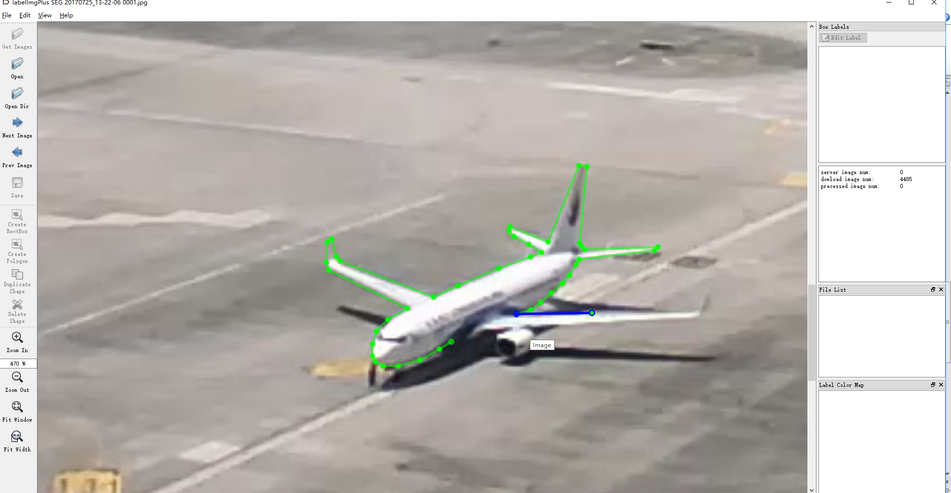
Annotated contour
-
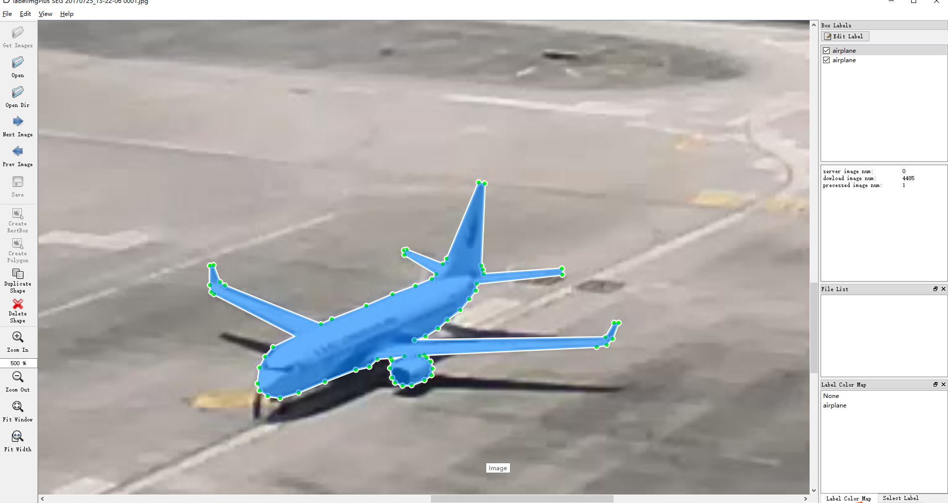
Mask
-
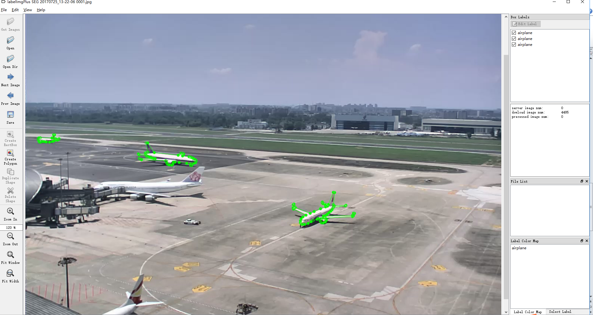
Annotation result
-
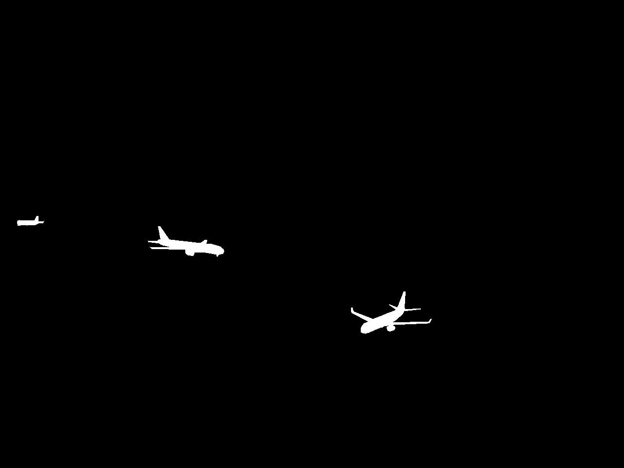
Ground truth